|
 |
When you fly from southeast Australia towards Southeast Asia, there is plenty to see if you know what you are looking for. A friend recently said that he had got in a bit of trouble with a flight attendant during a day flight between Manila and Sydney, just because he wanted to look out the window. If you are on an eight-hour daylight flight and only crossing two hours of time zone in longitude, why would your body need to sleep during the day?
To get the shots that I get from above, I always ensure to book seats in the last row on either side of the plane. Being right at the back, any impact to others working on their jetlag is at least minimised. I also quietly get my shots and my body clock thankfully remains pretty much close to normal when I get off the plane.
Final destinations determine your flight path over the massive Australian continent and anything you that you see below. Flights between Sydney and Singapore fly over some of the most spectacular desert environment which include the northern regions of South Australia where the Kati Thanda-Lake Eyre National Park, the Simpson Desert and the landscape around Innamincka are found. This path continues over the MacDonnell Ranges and Alice Springs in Central Australia to the Kimberley Ranges and the rugged coastline there subjected to eight metre tides.
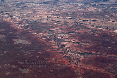
Flying to Manila in the Philippines, your path is further east, passing over the northern New South Wales tablelands and the western edge of the Great Dividing Range in Queensland. Above this western edge, hundreds of mostly dry creeks and rivers run southwest into the Channel Country which ultimately provides occasional floodwater to South Australia’s Lake Eyre Basin. Flying towards the Arafura Sea from the Queensland shore on the Gulf of Carpentaria, the last piece of the Australian continent crossed is the northeast tip of Arnhem Land, home of the Yolngu People near Nhulunbuy in the Northern Territory.
What you see in the following images are the same views that can be seen while crossing Australia during a daylight flight from Sydney to Manila. |
 |
|
 |
| To access the thirty larger (700 pixel wide photos) over three pages of views above northern Australia, click on the smaller photos or associated page links below. Links at the bottom of each page will take you to the following page or back to this index page. |
 |
Dry river valleys near Muttaburra, Outback Queensland. 21°53'49.0"S 144°40'32.9"E. High altitude shots from a flight between Sydney Australia and Manila, Philippines.
Photo © Peter Andrews / Outimage.
|
 |
|
| Above Australia's North. Photos by Peter Andrews: Page 1. |
 |
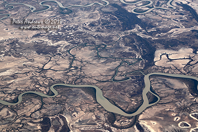
The Bynoe and Flinders Rivers wind their way through tidal mudflats towards the Gulf of Carpentaria, near Normanton in outback Queensland. 17°35'44.4"S 140°44'31.6"E. High altitude shots from a flight between Sydney Australia and Manila, Philippines.
Photo © Peter Andrews / Outimage.
|
 |
|
| Above Australia's North. Photos by Peter Andrews: Page 2. |
 |
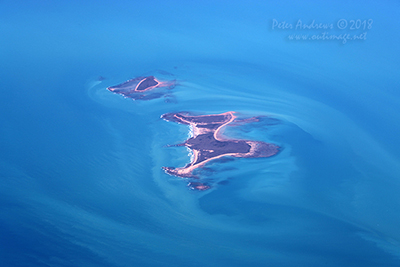
The Bountiful Islands in the Gulf of Carpentaria, near Burketown in outback Queensland. 16°34'12.4"S 139°57'24.5"E. High altitude shots from a flight between Sydney Australia and Manila, Philippines.
Photo © Peter Andrews / Outimage.
|
 |
|
| Above Australia's North. Photos by Peter Andrews: Page 3. |
 |
| Outimage Publications © 2018. |
|
|
|
| Outimage
Links and Site Info |
 |
 |
 |
| |
|
|
| |
|
 |
 |
| Outimage Help Page |
Copyright Info |
| |
|
|
 |
 |
| This
page was checked and found to be a valid
XHTML 1.0 Transitional webpage by the WC3
organisation. |
|
|
 |
|
|
 |
|
|
|
|

